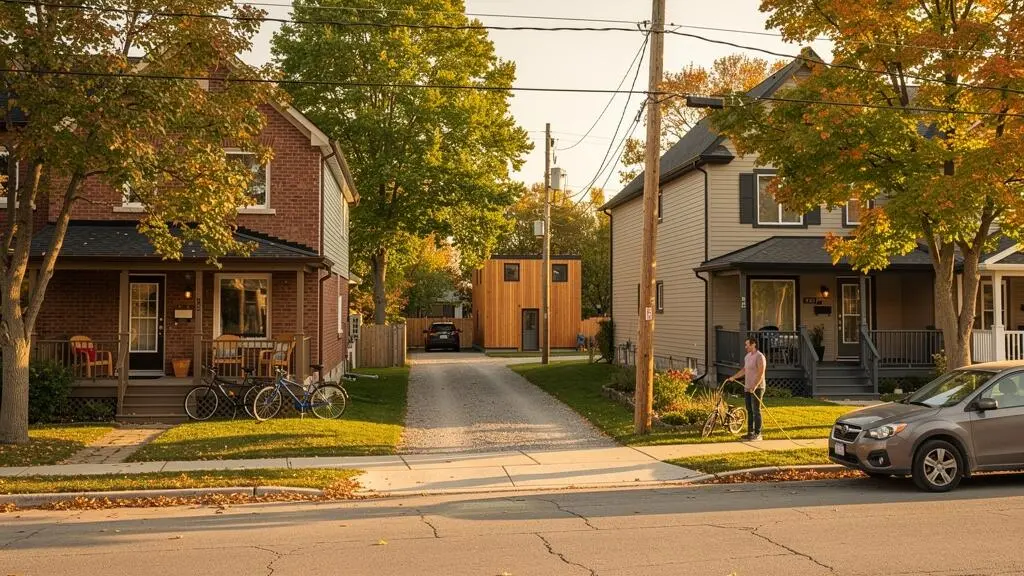
Canadian cities face a difficult housing challenge: accommodating more households without undermining the neighbourhood qualities that make communities desirable. Residents want attainable homes, reliable services, safe streets, accessible parks and enough space for everyday life. Yet adding housing often raises concerns about traffic, school capacity, building height and disappearing greenery.
Housing density does not have to mean overcrowding. A neighbourhood can accommodate more homes through multiplexes, secondary suites, mid-rise apartments and carefully located towers while remaining comfortable and attractive. The outcome depends on building design, infrastructure capacity, transportation options and how growth is distributed.
Different approaches suit different Canadian streets. Gentle density can diversify established low-rise neighbourhoods, mid-rises can reinforce commercial corridors, and taller buildings can concentrate housing near major transit stations. None is automatically appropriate everywhere.
The practical question is therefore not simply how many additional homes a city can permit. It is how housing growth can improve access to homes, services and transportation without transferring excessive costs or disruption to existing and future residents.
What makes higher housing density liveable?
- Gentle density can add homes across established neighbourhoods without requiring dramatic changes to building height or street character.
- Infrastructure, parks, schools and transportation must be assessed alongside housing capacity, with upgrades planned before serious shortages emerge.
- The most suitable housing form depends on street conditions, household needs, development feasibility and access to reliable transit—not density alone.
- Why Can Gentle Density Add More Homes Than Residents Expect?
- How Can Cities Add Density Without Overloading Local Services?
- Mid-Rise or High-Rise Housing: Which Fits Established Neighbourhoods Better?
- What Makes Housing Density Feel Overcrowded Instead of Liveable?
- When Should Transit Expansion Come Before Higher Housing Density?
- How Can You Set a Housing Budget That Reflects the Real Monthly Cost?
- Bus Rapid Transit or Rail: Which Fits a Growing Canadian Corridor?
- Can Urban Infrastructure Keep Up With Growth in Canadian Cities?
Why Can Gentle Density Add More Homes Than Residents Expect?
Gentle density can add substantial housing capacity because it allows several households to occupy land previously reserved for one dwelling. Duplexes, fourplexes, laneway homes and small apartment buildings increase the number of homes without necessarily creating much taller buildings. When these options become available across thousands of residential lots, modest individual projects can collectively create meaningful opportunities for new housing.
The distinction is between measured density and perceived density. Planners may measure residential density in dwellings per hectare, while residents generally experience building height, traffic, noise, setbacks, landscaping and activity along their street.
A fourplex that resembles a large detached house could accommodate four households on a lot previously limited to one. Its appearance might remain consistent with neighbouring buildings even though its residential density increases substantially.
This is the principle behind missing-middle housing: dwelling types between conventional detached homes and large apartment towers. Duplexes, triplexes, fourplexes, courtyard buildings and smaller apartment blocks provide different combinations of density, ownership arrangements and household sizes.
Toronto offers a documented example of zoning reform. In May 2023, City Council approved citywide permissions for multiplex buildings containing up to four residential units. In June 2025, it expanded permissions for up to six units in specified locations, including the Toronto and East York District and Ward 23. The City of Toronto’s multiplex housing regulations explain these permissions and the continuing requirements for development.
Toronto’s multiplex reform: What zoning permission actually changes
Toronto’s 2023 reform enabled up to four residential units in multiplex buildings across the city, allowing additional housing through eligible conversions or new construction.
The 2025 amendments extended six-unit permissions to selected areas rather than the entire city. These decisions increase permitted housing capacity, but they do not establish how many additional units will ultimately be constructed.
Similar planning approaches include laneway housing in Vancouver and broader infill permissions in Edmonton. Their common objective is to make smaller housing projects possible within neighbourhoods previously dominated by detached homes.
Existing roads, water connections and sewer networks can make infill development attractive compared with extending infrastructure into undeveloped areas. However, an existing connection does not guarantee that the underlying system has spare capacity. Replacement pipes, upgraded connections or additional public facilities may still be necessary.
Gentle density also has an important limitation: permission is not construction. A homeowner must still have a viable design, financing, suitable site conditions and the required approvals. Individual projects may add only a few homes, and their contribution accumulates gradually.
It is therefore difficult to claim that gentle density will always produce more housing than towers. A major high-rise project can deliver many units on one site, while gentle density depends on widespread participation across numerous properties.
For municipalities, the strongest approach is to permit suitable low-rise housing broadly, reduce unnecessary approval uncertainty and retain meaningful building standards. That creates opportunities for many smaller projects while leaving room for larger developments where local conditions justify them.
How Can Cities Add Density Without Overloading Local Services?
Cities can accommodate additional housing without overwhelming local services by measuring existing capacity, forecasting demand and coordinating infrastructure investment with development. Schools, sewers, emergency services and parks respond differently to growth, so each requires a specific assessment. Gradual infill can spread demand across multiple neighbourhoods, but it does not eliminate the need for upgrades where infrastructure is already constrained.
An important planning distinction is between average demand and peak demand. A water system may serve its users adequately over a typical day but face difficulties during periods of unusually high simultaneous consumption. Similarly, a school may have capacity across the wider district while one particular catchment faces enrolment pressure.
Adding several homes throughout a neighbourhood can be easier to accommodate than adding hundreds of dwellings at a single intersection. However, the effect depends on existing service conditions. Some established communities have unused capacity; others rely on aging networks already approaching their limits.
Canadian research has examined why spreading urban development outward creates infrastructure costs beyond the immediate construction of new houses. The Smart Prosperity Institute‘s research on suburban sprawl highlights the broader economic and environmental costs associated with outward expansion.
Infill development can reduce the need to build entirely new roads, utility corridors and public facilities over long distances. Yet its cost advantages are location-specific: an older sewer requiring major rehabilitation may be more expensive to upgrade than a nearby serviced site with adequate remaining capacity.
Municipalities therefore need to distinguish between an existing infrastructure asset and usable remaining capacity. The presence of a pipe, road or school is only the starting point for assessing whether growth can be supported.
Five checks before approving additional neighbourhood density
- Review school capacity. Obtain current enrolment and projected enrolment information for affected school catchments. Deliverable: a short school-capacity summary identifying potential pressure points.
- Confirm water and sewer conditions. Request available municipal servicing assessments and identify whether upgrades are required. Deliverable: a documented list of utility constraints and proposed improvements.
- Assess emergency service coverage. Review available fire and emergency medical service response information and planned service changes. Deliverable: an emergency-access assessment identifying any unresolved concerns.
- Map parks and daily amenities. Record walking routes to parks, schools, essential shops and public facilities, noting barriers to access. Deliverable: a neighbourhood accessibility map.
- Match growth with funded projects. Compare expected housing occupancy with infrastructure investment schedules. Deliverable: a timeline identifying responsible agencies, funding commitments and any gaps.
These checks should inform the pace and conditions of development rather than become an automatic justification for refusing additional housing. A municipality can investigate upgrades, coordinate construction phases and establish transparent servicing requirements where legally applicable.
Development charges and other growth-related funding mechanisms can help pay for eligible infrastructure, subject to provincial legislation and municipal rules. Charges should reflect applicable cost-allocation requirements, while capital planning should identify when necessary infrastructure can actually be delivered.
Ultimately, successful density planning is neither unrestricted construction nor indefinite delay. It is a process of identifying capacity, investing where required and allowing appropriately serviced housing to proceed.
Mid-Rise or High-Rise Housing: Which Fits Established Neighbourhoods Better?
Mid-rise buildings often provide a practical transition between detached neighbourhoods and busy urban corridors, while high-rises can accommodate considerably more housing near major transit stations. Neither building type is inherently more liveable. The better choice depends on street width, lot dimensions, neighbouring buildings, infrastructure capacity, construction feasibility and the amount of housing a location can reasonably support.
Mid-rise buildings commonly include approximately four to eight storeys, although definitions vary among municipalities and planning frameworks. They can introduce apartment housing along arterial roads without requiring the scale of a conventional residential tower.
Their relationship with the street is particularly important. Entrances, windows, shops and accessible public spaces can create activity at ground level. Upper-floor setbacks may help moderate the visual impact on adjacent lower-rise buildings, although the effectiveness depends on the actual dimensions and orientation.
High-rises offer a different advantage: substantially greater housing capacity on individual sites. Near rapid transit stations, major employment centres and established commercial districts, concentrating homes vertically can support walkable access to services.
Yet towers may introduce greater demands for structural systems, elevators, building management and complex construction logistics. These requirements can affect financing, construction timelines and development feasibility.
The following comparison identifies the principal trade-offs rather than assuming a universal winner.
| Planning criterion | Mid-rise housing | High-rise housing |
|---|---|---|
| Housing capacity | Moderate capacity distributed across multiple sites | Higher potential capacity on individual parcels |
| Street-level experience | Can provide frequent entrances and a pedestrian-oriented frontage | Depends heavily on podium design, setbacks and ground-floor uses |
| Shadows and wind | Often easier to integrate with lower-rise surroundings, subject to site design | Greater potential for extensive shadows and localized wind effects |
| Family suitability | Depends on unit sizes, layouts, storage and outdoor access | Also depends on unit mix, shared facilities and building management |
| Construction economics | May suit smaller development sites and different financing arrangements | Often requires larger capital commitments and more complex building systems |
| Approval and delivery | May be simpler where zoning and building conditions already support the form | Can involve more extensive technical assessments and construction requirements |
| Typical planning opportunity | Arterial streets, commercial corridors and transitions near low-rise housing | Major transit nodes, urban centres and locations suitable for concentrated growth |
A central issue is whether a street can physically accommodate the proposed form. A six-storey building on a sufficiently wide arterial with appropriate setbacks may integrate better than the same building on a narrow residential street immediately beside small detached homes.
Lot depth, access for deliveries, emergency vehicles, servicing and opportunities to consolidate properties can also determine whether an otherwise permitted project is feasible.
Project delivery introduces another distinction. Some mid-rise developments can be pursued by smaller or mid-sized builders, whereas major towers generally require substantial capital and organizational capacity. Nevertheless, mid-rise construction can also be expensive, particularly on constrained sites or where building-code requirements significantly affect costs.
Municipalities should therefore examine more than maximum permitted height. A housing strategy that allows theoretical density but produces financially unworkable designs may generate few completed homes.
Building form and development feasibility must be evaluated together. A city may benefit from mid-rise permissions along several suitable corridors while reserving additional height for locations with stronger transit connections and infrastructure.
The most liveable urban structure is often a combination of building types: lower-rise infill on residential streets, mid-rises along suitable corridors and taller development at selected transit nodes. The next challenge is ensuring that the homes and public spaces within those buildings remain comfortable.
What Makes Housing Density Feel Overcrowded Instead of Liveable?
Housing density feels overcrowded when the design of homes and public spaces fails to support the people using them. Too little indoor space, poor sound insulation, limited daylight, inaccessible parks and congested streets can undermine comfort regardless of building height. Well-designed dense neighbourhoods can remain liveable when housing quality, outdoor amenities, transportation and local services grow alongside the resident population.
Density and overcrowding are different concepts. Residential density generally describes how many dwellings or people occupy a defined land area. Household crowding concerns how many people share the space inside an individual home.
Statistics Canada defines persons per room by dividing the number of household members by the number of rooms in their dwelling. Its definition of persons per room provides a household-level crowding measure that is distinct from neighbourhood residential density.
A neighbourhood with numerous apartments may provide comfortable homes and accessible amenities. Conversely, a lower-density neighbourhood may contain households living in cramped or unsuitable accommodation. Neither situation can be evaluated through dwelling density alone.
The quality of the individual home is therefore fundamental. Families need layouts that can accommodate changing household needs, along with adequate storage, privacy and appropriate spaces for sleeping, working and everyday activities.
Daylight, ventilation and acoustic separation also affect comfort. A smaller apartment with a functional layout, good natural light and protection from neighbouring noise may be more pleasant than a larger home with substantial design shortcomings.
Neighbourhood design matters just as much. Tree canopy can provide shade, soften the visual impact of buildings and make streets more pleasant. Parks, playgrounds and shared courtyards provide outdoor space for residents who may not have private yards.
Ground-floor shops and everyday services can make compact neighbourhoods more convenient by reducing the distance between homes and daily destinations. However, commercial activity must be compatible with residential comfort, including appropriate consideration of noise, deliveries and pedestrian safety.
New housing can improve the public realm when development is coordinated with street trees, accessible sidewalks, cycling infrastructure and investments in community facilities. Poorly managed growth can have the opposite effect, particularly when public spaces remain unchanged while demand increases.
For residents reviewing a proposed development, two questions provide a useful test:
- Could a household with children live comfortably in the proposed homes for the next decade, considering layouts, privacy, storage, accessibility and nearby amenities?
- Would the development improve or worsen everyday street conditions for existing and future residents, including walking comfort, greenery, safety and access to shared public spaces?
These questions do not eliminate disagreements over height or neighbourhood change. They redirect the discussion toward observable qualities of liveability that can be evaluated through architectural plans, servicing assessments and public-realm design.
A successful housing policy should create homes people can comfortably occupy over time, not merely maximize units on a site. Achieving that outcome also depends on how residents travel to work, school and other daily destinations.
When Should Transit Expansion Come Before Higher Housing Density?
Transit expansion should precede or accompany major housing growth when existing services cannot reliably accommodate additional travel demand. Where frequent transit already operates with adequate capacity, housing can be added sooner. In developing corridors, coordinated investment and phased construction may be preferable to waiting for every transit project to finish or permitting extensive car-dependent growth without a credible transportation plan.
The challenge is sequencing. Building homes before transit improvements can increase congestion, overcrowd existing services and encourage car ownership. Building transit substantially ahead of development can leave expensive infrastructure operating below its potential while communities wait for new housing.
The appropriate balance depends on existing ridership, service frequency, available capacity, development timing and the certainty of future investment.
Transit-oriented development addresses this relationship by concentrating housing and employment around stations and frequent transportation corridors.
Metro Vancouver provides an established planning framework. TransLink‘s transit-oriented communities planning framework emphasizes destinations, distance, design, density, diversity and demand management.
Its guidance identifies approximately 800 metres as a typical walking distance to limited-stop rapid transit and 400 metres for local transit stops. These are planning reference distances, not guarantees that every resident can comfortably reach a station.
TransLink also distinguishes the densities associated with different transit services. Its general guidance references 60–350 combined jobs and people per hectare for limited-stop transit and 35–80 for local-stop corridors. These figures refer to people and jobs, not dwelling units, and they should not be treated as universal Canadian zoning requirements.
800 metres
TransLink identifies approximately 800 metres, or a 10-minute walk, as a typical planning distance to limited-stop rapid transit. Actual accessibility depends on the pedestrian network, physical barriers and individual mobility.
TransLink, Transit-Oriented Communities planning guidance.
Canadian cities illustrate different stages of transit-oriented growth. Vancouver has concentrated substantial development around SkyTrain stations, while Ottawa’s O-Train corridors demonstrate the connection between rapid-transit investment and changing land-use opportunities.
A useful intermediate approach is transit-ready planning. A municipality can identify appropriate future density, protect space for stations and bus priority measures, and coordinate development phasing with credible transportation commitments.
Where legally available, staged approvals or servicing arrangements may help match occupancy with infrastructure delivery. Such arrangements must follow applicable provincial and municipal requirements; transit-ready zoning is a planning approach rather than a single standardized Canadian legal mechanism.
Another consideration is how early transportation choices shape long-term behaviour. Residents moving into a new community without reliable transit may purchase vehicles and establish driving routines. Even when transit improves later, those habits can be difficult to change.
Parking supply, pedestrian connections, cycling routes and affordable access to frequent services should therefore be considered before residents move in, not only after congestion becomes visible.
The objective is not to require expensive rail infrastructure before every new building. It is to make sure residents have credible transportation choices when homes become occupied, while allowing housing growth to support better transit over time.
How Can You Set a Housing Budget That Reflects the Real Monthly Cost?
A realistic housing budget should include shelter expenses and transportation costs rather than comparing rents or mortgage payments alone. A centrally located home may cost more each month but reduce commuting expenses, while a cheaper suburban property may require additional vehicle spending. The appropriate choice depends on household income, financing, recurring ownership costs and the transportation options available in each neighbourhood.
Housing discussions often focus on the advertised price of a property or the monthly rent. Yet residents experience affordability through their complete household budget.
For a Canadian renter, recurring shelter expenses may include rent, electricity, heating, tenant insurance and other utilities not included in the lease.
Homeowners face a broader set of potential obligations: mortgage payments, property taxes, insurance, maintenance, utilities and applicable condominium fees. Some expenses are predictable; others can change considerably over time.
The comparison becomes more informative when housing and transportation are considered together.
Hypothetical example: Comparing two monthly household budgets
Consider a hypothetical Canadian household choosing between an apartment near frequent transit and a lower-priced home requiring regular car travel. The following amounts are illustrative only; they are not market estimates or figures for any particular Canadian city.
Option A — Transit-accessible apartment: CAD 2,350 in monthly shelter costs and CAD 200 in transportation costs, for a combined monthly expense of CAD 2,550.
Option B — Car-dependent home: CAD 1,950 in monthly shelter costs and CAD 800 in transportation costs, for a combined monthly expense of CAD 2,750.
In this hypothetical scenario, the apartment has higher shelter costs but a lower combined monthly expense. Actual results will depend on local prices, vehicle ownership, transit fares and household travel patterns.
The key calculation is straightforward:
Total monthly housing and transportation cost = shelter expenses + transportation expenses.
Transportation expenses may include vehicle financing, fuel, insurance, maintenance, parking and transit fares. For households with multiple vehicles, the difference between neighbourhoods can be particularly important.
Condominium ownership creates additional budgeting considerations. Monthly condominium fees may cover shared building expenses, but the services included vary by building. A lower purchase price does not necessarily translate into lower monthly costs when fees, taxes and utilities are added.
Owners should also consider the possibility of special assessments, sometimes called special levies, and increases in operating expenses or insurance premiums.
Before purchasing a condominium, reviewing the available reserve fund study, depreciation report where applicable, financial statements and relevant condominium documents can help identify future financial exposure. Document availability and terminology vary by province, so buyers should verify local disclosure requirements.
A practical starting guideline is to consider shelter spending around one-third of monthly take-home income. This is not a universal affordability rule, and it should not be confused with lender qualification tests or commonly used measures based on gross income.
Households with significant childcare costs, debt payments or irregular income may need a lower threshold. Others may reasonably choose a different balance based on their financial circumstances.
Rather than treating a percentage as a strict limit, establish an amount that leaves sufficient income for food, savings, emergencies and other recurring obligations. Then test potential homes against the complete monthly cost.
For planners, this household-level perspective matters because transportation infrastructure influences affordability. A neighbourhood that supports walking, cycling and reliable transit can give residents more ways to manage their expenses, even when individual housing prices remain high.
Bus Rapid Transit or Rail: Which Fits a Growing Canadian Corridor?
Bus rapid transit often suits corridors that need improved service relatively quickly, particularly when demand can be accommodated through dedicated bus infrastructure. Rail becomes more attractive where sustained ridership, station activity and long-term development plans justify its greater infrastructure commitment. The best choice depends on passenger demand, route conditions, costs, network integration and expected housing growth rather than a universal preference for either technology.
Bus rapid transit, or BRT, is more than a conventional bus route with frequent stops. Depending on the system, it may include dedicated lanes, priority at intersections, improved stations, off-board fare collection and other measures that make service faster and more reliable.
Light rail uses fixed tracks and stations, often with dedicated rights-of-way. Its vehicles can operate in larger configurations, although actual passenger capacity depends on service frequency, vehicle design, intersection conditions and operating arrangements.
Both systems can support dense neighbourhoods when designed to offer dependable travel times and convenient access.
| Criterion | Bus rapid transit | Light rail |
|---|---|---|
| Passenger capacity | Varies with bus size, frequency, stations and operating arrangements | Can accommodate substantial corridor demand using larger rail vehicles or trainsets |
| Capital investment | Often lower, particularly where existing roads can be adapted | Typically requires substantial track, power and station infrastructure |
| Construction | May be delivered in stages with less extensive civil works | Can involve more complex and disruptive construction |
| Route flexibility | Buses can be reassigned or extended beyond dedicated corridors | Services are tied to installed rail infrastructure |
| Long-term permanence | Strongest where dedicated lanes and permanent stations are protected | Fixed tracks can provide a visible long-term network commitment |
| Housing development relationship | Can improve access across several corridors and support distributed growth | Can reinforce concentrated development around established stations |
Canadian transportation experience shows why the choice is not straightforward.
Ottawa’s former Transitway illustrates the possibilities of a major bus-based rapid transit network and the complexities of transitioning portions of that network to rail. Such conversions can improve network capabilities but may involve substantial reconstruction and disruption.
In the Greater Toronto Area, Brampton’s Züm services and rapid-transit planning around the Hurontario corridor illustrate different approaches to improving urban transportation. The suitability of each depends on corridor-specific demand, infrastructure and land-use objectives.
Metro Vancouver’s established SkyTrain network provides another example of fixed-guideway transit supporting concentrated station-area development. That does not establish that every growing corridor requires rail; bus priority can also be valuable where ridership patterns and budgets favour it.
One important distinction is infrastructure permanence. Rail tracks and stations provide a visible commitment to particular locations, which can influence expectations about future accessibility. Dedicated BRT infrastructure can provide similar confidence when its lanes, stations and operating resources are protected over the long term.
However, neither mode guarantees new housing construction. Development also depends on zoning permissions, land availability, market feasibility and infrastructure capacity.
The relationship between transit and housing creates a planning challenge: higher-density development can produce the ridership needed to justify substantial transit investment, but developers and residents may hesitate to depend on transportation improvements that remain uncertain.
A staged BRT-to-rail approach may appear attractive because it enables earlier service improvements. Yet it is not automatically inexpensive. Converting a functioning bus corridor may require new infrastructure, service diversions and reconstruction of existing facilities.
Municipalities should therefore assess the whole-life costs and performance of each approach, not just the initial capital price. This includes operation, maintenance, capacity, resilience and how well each mode connects with the wider network.
Where housing growth will be distributed across several corridors, improved bus networks may offer a practical way to expand access. Where a corridor is expected to sustain concentrated demand over decades, higher-capacity rail may warrant closer evaluation.
The right transit investment should make planned neighbourhoods easier to reach and less dependent on private vehicles. Whether that requires dedicated buses or rail is ultimately a question of measurable corridor needs and credible growth forecasts.
Key takeaways for assessing the next stage of urban growth
- Separate permissions from delivery. Zoning may permit more housing, but completed homes also depend on feasible construction and functioning infrastructure.
- Test the timing of investments. Transit, utility upgrades and community facilities need schedules aligned with when residents will actually move in.
- Make infrastructure evidence public. Transparent capacity assessments and capital plans help distinguish manageable growth from genuine service constraints.
Can Urban Infrastructure Keep Up With Growth in Canadian Cities?
Canadian urban infrastructure can support additional housing growth when municipalities coordinate development permissions with maintenance, system upgrades and long-term capital investment. The challenge is not simply building new infrastructure. Cities must also renew aging roads, pipes and public facilities while determining where existing networks have enough capacity for additional residents. Transparent funding and realistic construction schedules are essential.
Municipal growth involves two infrastructure responsibilities that often compete for the same resources: maintaining existing assets and expanding capacity.
Established neighbourhoods already have water mains, sewers, roads, sidewalks and other services. This makes them attractive locations for infill housing because development may not require entirely new networks.
However, infrastructure age and spare capacity are separate concerns. A neighbourhood may have sufficient theoretical servicing capacity but depend on aging pipes requiring replacement. Another may have relatively modern infrastructure but limited ability to accommodate additional peak demand.
Both situations require investment decisions informed by engineering assessments.
Development charges are one mechanism Canadian municipalities may use to recover eligible growth-related capital costs. Their application depends on provincial legislation, local bylaws, exemptions and the type of development involved.
Other infrastructure funding may come from municipal revenues, utility rates, borrowing, and provincial or federal funding programs. The availability and conditions of these resources vary by project and jurisdiction.
Funding arrangements can be complicated because the institutions responsible for housing approvals are not always responsible for every affected service. Municipalities, school boards, transit agencies, utilities and provincial governments may each control different components of growth-related investment.
Infrastructure planning also operates on a different timeline from individual development approvals. Major water facilities, sewer upgrades and transit investments can require lengthy planning, financing, procurement and construction processes.
A municipality may therefore approve residential capacity long before every supporting capital project is complete. The reverse problem can occur when infrastructure is built for anticipated growth that takes longer than expected to materialize.
This timing mismatch makes coordinated capital planning essential.
Ontario’s Bill 23, introduced in 2022, illustrates how changes to development rules and growth-related financing can become part of broader debates about housing supply and municipal infrastructure. Its provisions and subsequent legislative changes must be assessed using the law applicable to the municipality and project at the relevant time.
Even when zoning restrictions are relaxed, servicing constraints can remain a major barrier to development. This creates a risk that insufficient infrastructure investment will prevent communities from realizing housing capacity they have already decided to permit.
At the same time, infrastructure capacity cannot be assumed simply because a site is located within an established urban area. Genuine constraints must be identified and addressed through appropriate technical work.
Residents and planners can evaluate a municipality’s preparedness by examining several categories of public information:
- Water and wastewater assessments: Do published plans identify available capacity, system limitations and required upgrades in growth areas?
- Infrastructure asset management: Are maintenance backlogs and replacement needs recognized alongside expansion projects?
- School board capital planning: Do enrolment projections and planned facilities reflect expected neighbourhood population changes?
- Transit investment schedules: Are service improvements supported by credible timelines and funding arrangements?
- Growth-related financing: Do capital budgets explain how development charges and other funding sources will support eligible infrastructure, and where investments will occur?
No single indicator proves that a city is keeping up. A strong financial plan may still encounter construction delays, while a capacity study may need updating as development patterns change.
The most useful approach is to compare housing forecasts, infrastructure capacity and funded delivery schedules regularly. When assumptions change, municipalities should explain whether service improvements, development phasing or investment priorities need adjustment.
Gentle density can help limit the infrastructure demands associated with outward expansion, but it does not remove the need to renew established systems. Major developments can contribute to infrastructure investment, but they also create concentrated demands that require careful assessment.
For residents, homeowners and planners, a constructive next step is to review the municipality’s current housing growth forecasts alongside its published servicing studies and capital budget. Identifying where housing permissions, available capacity and funded infrastructure projects align provides a stronger basis for decisions than opposing or supporting density solely on principle.
Does allowing a fourplex mean four homes will actually be built?
No. Zoning permission establishes what may be allowed on a property, subject to applicable requirements. Construction still depends on site conditions, building permits, financing and whether a project is economically feasible. Toronto’s multiplex reforms illustrate the difference between permitting additional units and measuring completed housing.
Can housing density increase without removing mature neighbourhood trees?
Yes, although outcomes depend on site design and local requirements. Building placement, reduced unnecessary paved areas, landscaping plans and appropriate protection of existing trees can help retain greenery. Some projects may still require tree removal, so residents should examine the actual site plan and applicable municipal tree-protection rules rather than assume every form of density has the same impact.
Are secondary suites and laneway homes suitable for every residential lot?
Not necessarily. Lot dimensions, access, servicing, building-code compliance and local zoning rules can affect feasibility. A property may be eligible for an additional dwelling in principle but unable to accommodate a particular design without substantial changes. Owners should confirm current municipal permissions and site-specific requirements before making financial commitments.
Does more housing automatically make a neighbourhood more affordable?
No. Additional housing can expand the range of available homes and help address supply constraints, but affordability also depends on household incomes, land costs, financing, construction expenses and the types of homes delivered. A more complete affordability assessment considers housing quality, location and transportation expenses alongside advertised rents or purchase prices.
What should residents examine before supporting or opposing a proposed density increase?
Residents should examine the proposed dwelling mix, building design, accessibility, tree protection, servicing capacity, transit options and impacts on public spaces. Available municipal planning reports, infrastructure assessments and capital plans can clarify which concerns are supported by evidence and which design or investment changes might improve the proposal. The central question is whether the additional homes can be accommodated comfortably and responsibly.